亚特兰大地区天气预报:高温,然后是凉爽的空气和火灾风险
Read, Watch or Listen
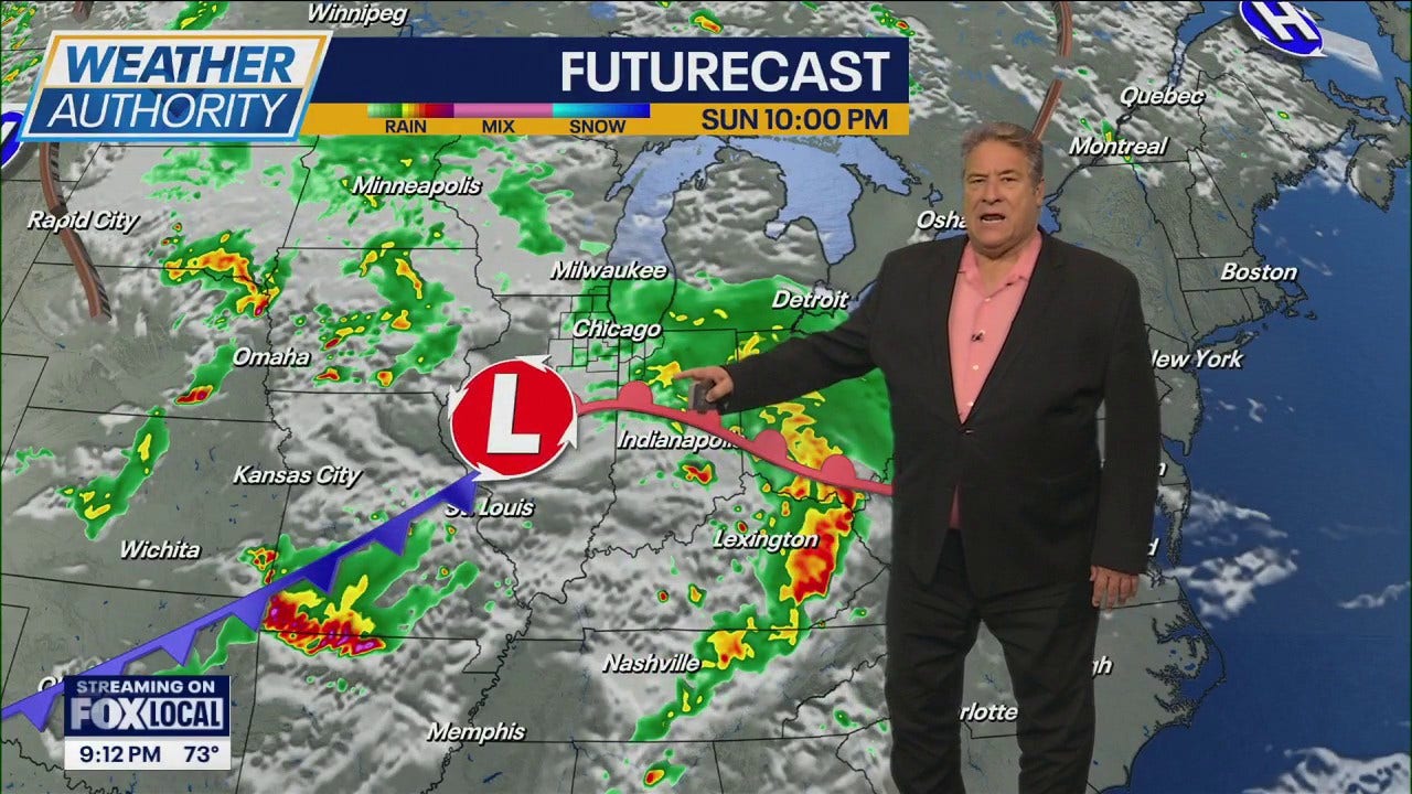
亚特兰大,佐治亚州——一股强大的高压脊从墨西哥湾延伸而来,今天将使亚特兰大和佐治亚州大部分地区保持非常温暖和干燥的天气,天空大部分晴朗,西南风微风,气温从今晨的60多华氏度升至今天下午的80多华氏度至90华氏度。高温可能会在一些地区挑战日纪录。低湿度、阵风和干燥的植被是任何有户外活动计划的人的主要担忧。今天晚些时候,一股冷锋将穿过田纳西河谷进入佐治亚州西北部,预计会带来一条有组织的阵雨带,甚至可能有一两个孤立的雷暴,但降雨量可能有限,而且阵雨带应该会在日出时减弱。 冷锋过后,一个凉爽得多的干燥空气团将笼罩该地区,与周六的高温形成鲜明对比。周日下午将有微风,西北风约10-15英里/小时,阵风高达25英里/小时,非常低的相对湿度将引发火灾天气担忧;某些地区可能需要发布红色警告。周日晚间,内陆地区的气温将降至40多华氏度。高压将在下周初建立,在未来七天内保持干燥和温和的天气,火灾危险持续存在,有益的降雨机会有限,气温将在本周中后期恢复到高于正常水平。
Prepared by Emily Rhodes and reviewed by editorial team.
Timeline of Events
- 高压和墨西哥湾脊将给东南地区带来创纪录的温暖和干燥天气(周六)。
- 西南风和低湿度将持续到周六下午,火灾风险升高。
- 冷锋将于周六晚些时候至周日早些时候到来,带来有组织的阵雨和零星雷暴。
- 雨水将于周日上午结束;周日至周一气温将急剧下降,伴有北/东北方向的微风。
- 凉爽、干燥的空气和阵风将持续到周一至周二,之后在中期逐渐回暖。
Why This Matters to You
此次天气变化将影响您的周末计划。如果您在户外,请注意因湿度低和阵风而引发的火灾风险。突然的降温可能会影响您的健康,尤其是当您对寒冷敏感时。请检查您的供暖系统是否运行正常。
The Bottom Line
天气正迅速从创纪录的高温转变为冷锋。请为阵雨、可能出现的风暴和气温大幅下降做好准备。留意“红旗警告”。如果知道有人计划本周末进行户外活动,值得转发。
- Articles Published:
- 4
- Right Leaning:
- 0
- Left Leaning:
- 0
- Neutral:
- 4
- Distribution:
- Left 0%, Center 100%, Right 0%
应急管理者、沿海港务局和受天气影响的商家受益于提前预报和时机,这使得他们能够为阵风、局部阵雨和寒冷天气做好准备。
户外活动组织者、休闲船只使用者和受干旱影响的社区持续面临火灾天气风险,降雨量有限,部分地区仍不太可能看到有意义的干旱缓解。
Coverage of Story:
From Left
No left-leaning sources found for this story.
From Center
亚特兰大地区天气预报:高温,然后是凉爽的空气和火灾风险
https://www.atlantanewsfirst.com https://www.wbtv.com https://www.wbrc.com WPTVFrom Right
No right-leaning sources found for this story.


Comments