National Hurricane Center Activates Tracking as Tropical Storm Polo Forms with Threat to Southwest US
PUBLISHED Sep 21, 2026, 2:17 AM ET
Read, Watch or Listen
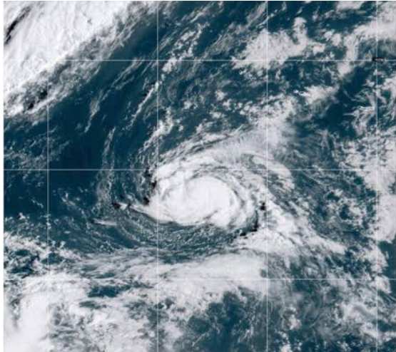
Tropical Storm Polo has formed off the southwestern coast of Mexico, prompting active tracking and monitoring by the U.S. National Hurricane Center in Miami. Developed late Sunday, the system packed maximum sustained winds near 40 miles per hour and was projected to intensify rapidly into a major hurricane by midweek. According to official advisories, the storm was centered about 270 miles south of Manzanillo, Mexico, and moving toward the east-northeast at 5 miles per hour. Forecasters outline a projected path featuring a turn toward the east on Tuesday followed by a sharp turn north and northwest on Wednesday. Heavy rainfall is expected to impact the Mexican states of Michoacán, Colima, and Jalisco through Thursday, bringing localized flooding risks. While currently tracking off the Mexican coastline, meteorological authorities continue monitoring marine conditions and long-range trajectory modeling to evaluate potential regional impacts across North American coastal corridors.
By Neha R. | JQJO News
Timeline of Events
- On September 15, 2026, meteorological models detected initial convective activity brewing off southwestern Mexico.
- On September 18, 2026, atmospheric precursors indicated favorable conditions for organized tropical cyclone development.
- On September 20, 2026, the National Hurricane Center designated the system as a tropical depression.
- On September 20, 2026, Tropical Storm Polo officially formed with winds near forty miles per hour.
- On September 21, 2026, official advisories confirmed the storm's position two hundred seventy miles south of Manzanillo.
- On September 21, 2026, forecasters reported the system moving east-northeastward at a slow speed of five miles per hour.
- On September 22, 2026, forecasters anticipate the storm executing a gradual eastward turn over warm Pacific waters.
- On September 23, 2026, meteorologists project a sharp turn toward the north and northwest accompanied by rapid strengthening.
- On September 24, 2026, heavy rainfall and localized flooding risks are expected to peak across coastal Mexican states.
- On September 25, 2026, authorities expect the system to reach major hurricane status while evaluating broader trajectory shifts.
News Intelligence
- Immediate US impact: Emergency managers monitor Pacific storm tracks for potential southwestern impacts.
- Possible long-term US impact: Long-range moisture feeds could alter regional western precipitation patterns later.
- Most affected groups: Coastal residents, emergency planners, mariners, and meteorological agencies monitor developments.
- Reader Priorities: Track official National Hurricane Center updates and local marine weather advisories.
- Articles Published:
- 26
- Right Leaning:
- 0
- Left Leaning:
- 5
- Neutral:
- 21
- Distribution:
- Left 19%, Center 81%, Right 0%
Left: Highlights climate change connections and broader environmental risk trends. Center: Focuses strictly on official meteorological data, coordinates, and wind speeds. Right: Emphasizes emergency preparedness, tracking logistics, and potential economic impacts.
National Hurricane Center reported Tropical Storm Polo formation on September 20, 2026. https://apnews.com/article/tropical-weather-polo-mexico-d577337f3e70fbf4f0c7dac7902edb4e
Coverage of Story:
From Left
Tropical Storm Polo forms off southwestern Mexico
SFGATE Washington Post CNN NBC News Los Angeles TimesFrom Center
Tropical Storm Polo forms off southwestern Mexico
Associated Press Local 10 News ClickOnDetroit News4JAX KSAT WSLS Bangor Daily News KVUE Daily Journal Tribune-Town WBAL Baltimore News WBOC Vernon Matters Fraser Valley Today EverythingGP BattlefordsNow Bastille Post Reuters Bloomberg USA Today Miami HeraldFrom Right
No right-leaning sources found for this story.






Comments