Palos Fire Erupts and Threatens Homes in Los Angeles County
PUBLISHED Sep 14, 2026, 7:21 PM ET
Read, Watch or Listen
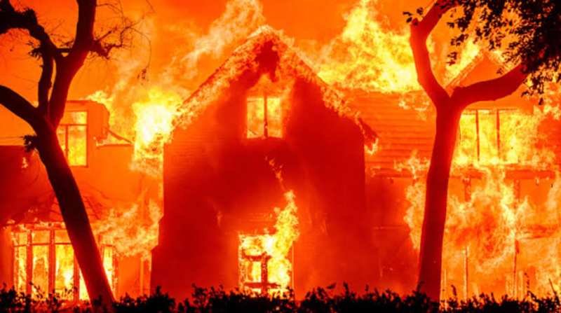
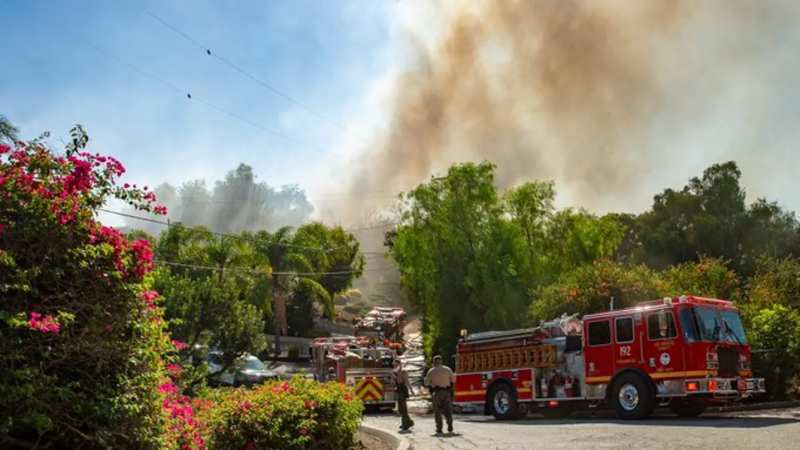
A fast-moving brush fire known as the Palos Fire broke out Monday afternoon in Whittier, Los Angeles County, forcing mandatory evacuations and structure threats near the Orange County border. The fire initiated shortly after 2:30 p.m. local time in the 2400 block of Las Palomas Drive. Driven by local winds and terrain, the blaze expanded uphill toward La Habra Heights, consuming roughly 12 to 20 acres and destroying at least one residential structure. The Los Angeles County Fire Department and the Orange County Fire Authority deployed ground engines and aerial water-dropping aircraft to counter the advance. Local authorities established evacuation warnings and orders across designated zones, while the American Red Cross opened an emergency reception center at Los Altos High School in Hacienda Heights [cite: 1.1.3]. No injuries or fatalities have been officially reported as fire crews continue defensive containment operations along the ridge [cite: 1.1.1].
By Yusra M. | JQJO News
Timeline of Events
- On June 17, 2026, a separate major warehouse fire erupted at 1400 South Los Palos Street in Boyle Heights [cite: 1.1.4].
- On June 24, 2026, firefighters declared a knockdown on the prior Boyle Heights industrial cold-storage facility fire [cite: 1.1.4].
- On September 9, 2026, the Getty Fire maintained a ninety percent containment status in the Bel-Air area.
- On September 14, 2026 at 2:30 p.m., the Palos Fire ignited in the 2400 block of Las Palomas Drive.
- On September 14, 2026 at 3:20 p.m., county fire officials confirmed the brush fire had burned ten acres [cite: 1.1.3].
- On September 14, 2026 at 4:00 p.m., the Cal Fire and Los Angeles County data updated the burn footprint to twelve acres [cite: 1.1.5].
- On September 14, 2026, aerial broadcast feeds captured at least one residential home fully engulfed and collapsing [cite: 1.1.3].
- On September 14, 2026, authorities issued mandatory and voluntary evacuation warnings across La Habra Heights zones.
- On September 14, 2026, the American Red Cross opened an evacuation support center at Los Altos High School [cite: 1.1.3].
- On September 14, 2026, evening incident commanders reported twenty acres burned with potential expansion toward thirty acres [cite: 1.1.3].
- On September 15, 2026, fire crews maintained overnight defensive lines and air-support operations to prevent further neighborhood destruction.
- In coming days, fire investigators will determine the exact ignition cause while crews monitor containment progress [cite: 1.1.1].
News Intelligence
- Immediate US impact: Evacuations and property threats prompt emergency responses in Southern California.
- Possible long-term US impact: Heightened insurance and fire-mitigation reviews for wildland-urban interface communities.
- Most affected groups: La Habra Heights residents, Whittier homeowners, Los Angeles County firefighters.
- Reader Prioritization: Official county evacuation alerts, local air quality advisories, and road closures.
- Articles Published:
- 28
- Right Leaning:
- 4
- Left Leaning:
- 8
- Neutral:
- 16
- Distribution:
- Left 29%, Center 57%, Right 14%
Left: Emphasizes community displacement, home destruction, and climate-linked regional vulnerability. Center: Focuses strictly on containment acreage, evacuation zones, and agency firefighting logistics. Right: Highlights rapid local emergency response, community defense, and property protection efforts.
Los Angeles County Fire Department reported initial brush fire at 2:30 p.m. on September 14, 2026 [cite: 1.1.2]. https://www.latimes.com/california/story/2026-09-14/lacounty-brush-fire
Coverage of Story:
From Left
Brush fire burns at least one home in La Habra Heights; LA County evacuation warnings issued
CBS News ABC News NBC News CNN ABC 7 Los Angeles New York Times Washington Post MSNBCFrom Center
Brush fire triggers evacuation warnings in La Habra Heights as flames threaten structures
Los Angeles Times Hindustan Times San Luis Obispo Tribune Los Angeles Fire Department Associated Press Reuters USA Today KTLA 5 Los Angeles NBC 4 Los Angeles KCAL News FOX 11 Los Angeles San Gabriel Valley Tribune The Hill Axios LAist NewsweekFrom Right
California firefighters tackle Palos Fire as mandatory evacuations ordered in La Habra Heights
Fox News Orange County Register Wall Street Journal Epoch Times





Comments