Severe Storms Threaten 38 Million Across Northeast
Tap title to read story
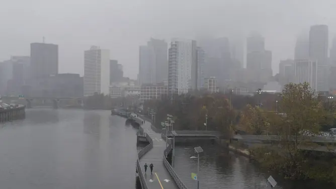
A powerful cold front advancing across the East Coast threatened over 38 million residents throughout the Northeast with severe thunderstorms, damaging winds, tornadoes, and flash flooding. Major metropolitan hubs including Washington D.C., Philadelphia, Baltimore, and New York City fell squarely within the primary risk zone as torrential downpours triggered localized flood warnings. The National Weather Service tracked severe convective activity that caused hundreds of flight cancellations along the crucial I-95 aviation corridor, disrupting travel for millions. The New York metropolitan area entered a designated tornado risk zone for the seventh time during the year, marking a sharp increase compared to previous seasons. Accumulated rainfall totals ranging between one and two inches compounded saturation issues across the region following an unusually wet summer. More than 25 million people remained under active flood advisories as emergency management authorities monitored rising water levels and localized street inundation extending into Friday morning.
Timeline
- On August 1, 2024, Philadelphia recorded multiple flash flood warnings during summer months.
- On August 15, 2024, heavy seasonal rainfall continued saturating northeastern urban drainage networks.
- On August 25, 2026, meteorologists tracked a powerful cold front moving eastward.
- On August 27, 2026, severe storm warnings activated across major mid-atlantic metropolitan areas.
- On August 28, 2026, severe thunderstorms disrupted hundreds of flights along I-95 corridor.
- On August 28, 2026, New York entered a tornado risk zone for seventh time.
- On August 28, 2026, flash flood warnings extended from Philadelphia to southern New York.
- On August 29, 2026, residual flood advisories persist into early morning hours Friday.
- On September 5, 2026, emergency agencies expect complete recovery from saturated ground conditions.
- On October 1, 2026, climatologists will release final seasonal storm frequency statistics.
Sources
JQJO Editorial Desk · Human reviewed · AI assisted. Report a correction.