Unseasonable warmth ends as cold front brings storms
Read, Watch or Listen
Baton Rouge. Forecasters reported unseasonably warm conditions across parts of the Southeast, Mid-Atlantic and central Appalachia this week, with daytime highs in the upper 80s to low 90s through Friday. High-pressure ridging maintained dry, warm weather, while computer models indicated an approaching cold front late Saturday into Sunday that would bring showers and storms. Immediate impacts include expected dry, pleasant conditions for Friday evening events — including LSU baseball and softball in Baton Rouge — and elevated fire-weather concerns where dryness persisted. By Saturday afternoon into Saturday night some regions face isolated severe-wind and hail threats, with cooler, drier air settling in by Sunday and early next week.
Prepared by Emily Rhodes and reviewed by editorial team.
Timeline of Events
- Early week: high-pressure ridge established warm, dry conditions across multiple regions.
- Thursday–Friday: daytime highs reached upper 80s to low 90s; outdoor events favored dry weather.
- Friday evening: LSU softball and baseball scheduled to play under warm, dry conditions in Baton Rouge.
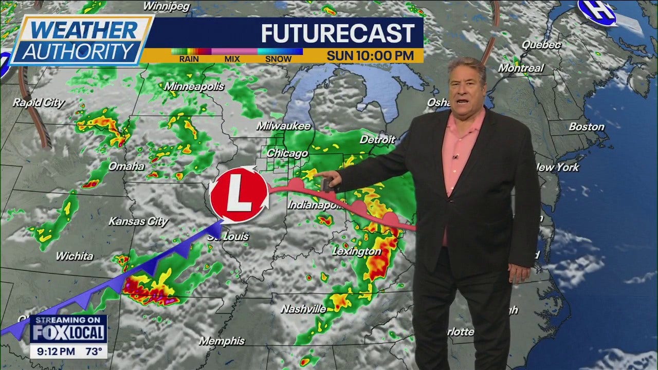
- Saturday: cold front approaches; models and local offices warn of showers and potential isolated severe storms, WTAP highlights 2–8 p.m. risk window.
- Saturday night–Sunday: front moves through, bringing showers, isolated severe storms, and cooler, drier air into early next week.
Why This Matters to You
The forecast change affects your weekend plans. If you're in the Southeast, Mid-Atlantic, or central Appalachia, expect storms on Saturday. Outdoor events, like LSU games in Baton Rouge, should be fine on Friday. But watch out for fire risks in dry areas.
The Bottom Line
Stay informed and prepared. Check local weather updates, especially if you're planning outdoor activities on Saturday. The shift to cooler, drier air by Sunday could also affect your home heating needs. Worth forwarding if you know someone with weekend plans.
- Articles Published:
- 4
- Right Leaning:
- 0
- Left Leaning:
- 0
- Neutral:
- 4
- Distribution:
- Left 0%, Center 100%, Right 0%
Agricultural areas, municipal water supplies, and outdoor event organizers benefited from warmer, dry conditions before the incoming rain improved soil moisture.
Communities in parts of the Ohio Valley and central Appalachia faced elevated severe-weather and fire-weather risks, potentially stressing emergency services and causing localized property damage.
Coverage of Story:
From Left
No left-leaning sources found for this story.
From Center
Unseasonable warmth ends as cold front brings storms
WAFB https://www.wsfa.com WJLA https://www.wtap.comFrom Right
No right-leaning sources found for this story.


Comments