First Alert Weather Day on Tuesday evenings due to strong to severe storms
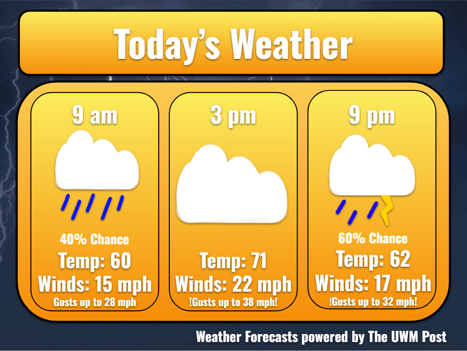
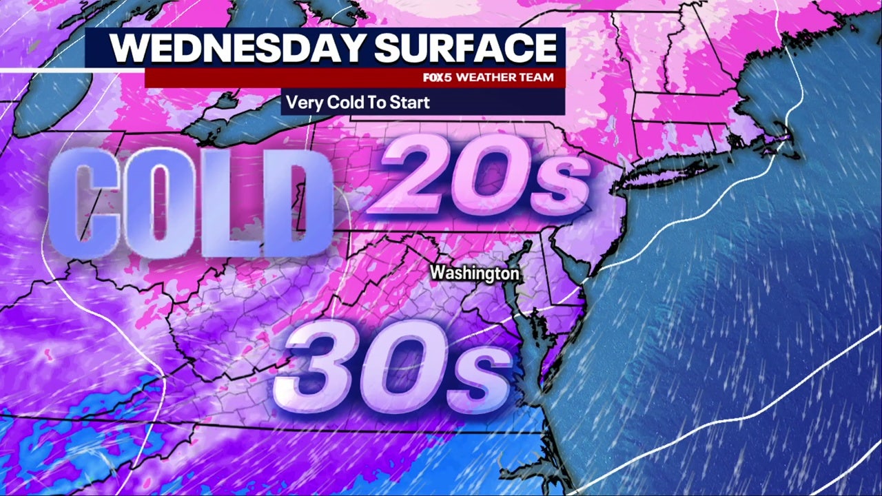
Central Wisconsin faces an unsettled stretch, with rounds of rain and thunderstorms, brief sun breaks, and temperatures above average through late week. Showers fade northwest to southeast by early Tuesday, but heavy rain and small hail remain concerns, and flooding is possible along high rivers. A First Alert Weather Day is in effect Tuesday evening for areas around and south of Highway 10, with severe threat of large hail near Madison and Milwaukee 4 to 10 PM. Another round is likely Wednesday, then showers taper Thursday before a cooler weekend brings rain to snow showers and a chilly Sunday.
Prepared by Olivia Bennett and reviewed by editorial team.
- Articles Published:
- 3
- Right Leaning:
- 0
- Left Leaning:
- 0
- Neutral:
- 3
- Distribution:
- Left 0%, Center 100%, Right 0%
Coverage of Story:
From Left
No left-leaning sources found for this story.
From Center
First Alert Weather Day on Tuesday evenings due to strong to severe storms
https://www.wsaw.com https://www.cleveland19.com WEWSFrom Right
No right-leaning sources found for this story.


Comments