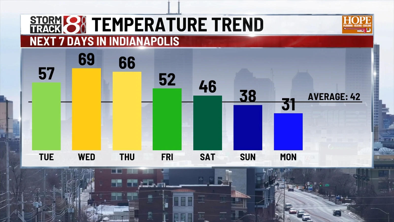
Unseasonable warmup, fog advisories, midweek gusts expected
Tap title to read story
Indianapolis and regional forecasts report an unseasonable warmup this week, with dense fog advisories Monday morning and highs expected to climb into the 60s and 70s by midweek. Meteorologists warn gusty southerly winds Wednesday with a midweek cold front bringing scattered showers and limited rain late week. Forecast models show regional variation, with coastal areas remaining slightly cooler than inland zones, and forecasters emphasize travel impacts from fog and breezy conditions. Dense fog has reduced visibility this morning in many locations and created travel hazards. Local offices also note potential record highs later in the week and issued advisories to monitor closely. Based on 7 articles reviewed and supporting research.
More context
Timeline
- 1. Dense fog advisory impacts travel Monday morning across multiple regions.
- 2. Monday temperatures moderate, many areas reach above-average highs in the 40s–60s.
- 3. Tuesday–Wednesday bring significant warmup with highs into the 60s and 70s, flirting with records.
- 4. Midweek cold front arrives Wednesday, creating gusty winds and scattered showers.
- 5. Late-week low-pressure system may stall, producing light rain chances Friday through the weekend.
Sources
JQJO Editorial Desk · Human reviewed · AI assisted. Report a correction.