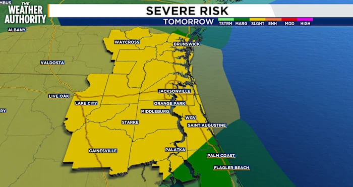
Strong storms threaten Southeast Georgia and Northeast Florida Sunday
Tap title to read story
0:00 / 0:44
JACKSONVILLE, Fla. Meteorologists warn that a cold front moving east from the lower Mississippi Valley will bring strong to severe thunderstorms across Southeast Georgia and Northeast Florida on Sunday. Forecast models show a squall line arriving between 2–8 p.m. with damaging wind gusts, tornadoes, and heavy rain possible. The Storm Prediction Center placed portions of the region in Marginal to Slight Risk. Wind advisories and marine gale warnings were issued; rainfall totals of 0.5–1.5 inches were forecast for some areas. Residents should secure outdoor items and monitor updates. Based on 6 articles reviewed and supporting research.
More context
Timeline
- 1. Cold front moves east from the lower Mississippi Valley toward the Gulf and Southeast.
- 2. SPC and local forecast offices issue Marginal-to-Slight risk designations and advisories.
- 3. Model guidance projects squall line organization with arrival windows spanning early morning to evening.
- 4. Wind advisories and marine warnings issued; expected gusts up to 40–45+ mph in spots.
- 5. Storms pass east Sunday night, rain tapers, and cooler, drier air moves in.
Sources
JQJO Editorial Desk · Human reviewed · AI assisted. Report a correction.