Midweek Cold Front Brings Snow, Wind Across Region
Read, Watch or Listen
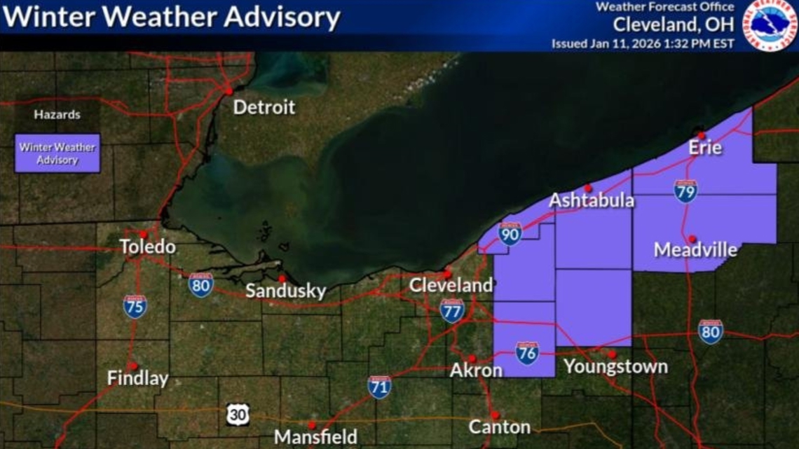
Cleveland — National Weather Service and local stations reported a series of winter systems moving across the Midwest and Mid‑South this week, bringing gusty winds, rain changing to snow, and light accumulations in higher elevations. Advisories and Weather Impact Alerts were issued for parts of Northeast Ohio, Kentucky, Tennessee, and West Virginia. Forecasters forecasted highs in the 50s then rapid temperature drops with cold fronts midweek, producing scattered snow showers, snow squalls in some areas, and travel impacts from slippery roads and reduced visibility. Local agencies advised caution during commutes. Based on 6 articles reviewed and supporting research. Further confirmation.
Prepared by Olivia Bennett and reviewed by editorial team.
Timeline of Events
- Early week: brief mild conditions with highs near the 50s and gusty winds.
- Pre‑front: National Weather Service and local stations issued advisories and Weather Impact Alerts.
- Midweek: cold front moved through, producing rain that transitioned to snow from northwest to southeast.
- Midweek evening: scattered snow showers and localized snow squalls produced light accumulations, mainly at higher elevations.
- Post‑front: temperatures fell into the 20s and teens with wind chills, prompting continued cold conditions.
- Articles Published:
- 6
- Right Leaning:
- 0
- Left Leaning:
- 0
- Neutral:
- 6
- Distribution:
- Left 0%, Center 100%, Right 0%
Emergency management, road crews, and local agencies benefited from advance forecasts and alerts that allowed preparation and targeted response to expected gusty winds, rain‑to‑snow transitions, and potential travel disruptions.
Motorists, commuters, and residents in elevated and lake‑effect areas suffered travel delays, reduced visibility, and slick road conditions resulting from snow bands and rapidly falling temperatures.
Coverage of Story:
From Left
No left-leaning sources found for this story.
From Center
Midweek Cold Front Brings Snow, Wind Across Region
WKYC 3 Cleveland WHAS 11 Louisville https://www.wtap.com WSMV Nashville WKEF https://www.wkyt.comFrom Right
No right-leaning sources found for this story.


Comments