California wildfire spreads rapidly in Kern County
Read, Watch or Listen
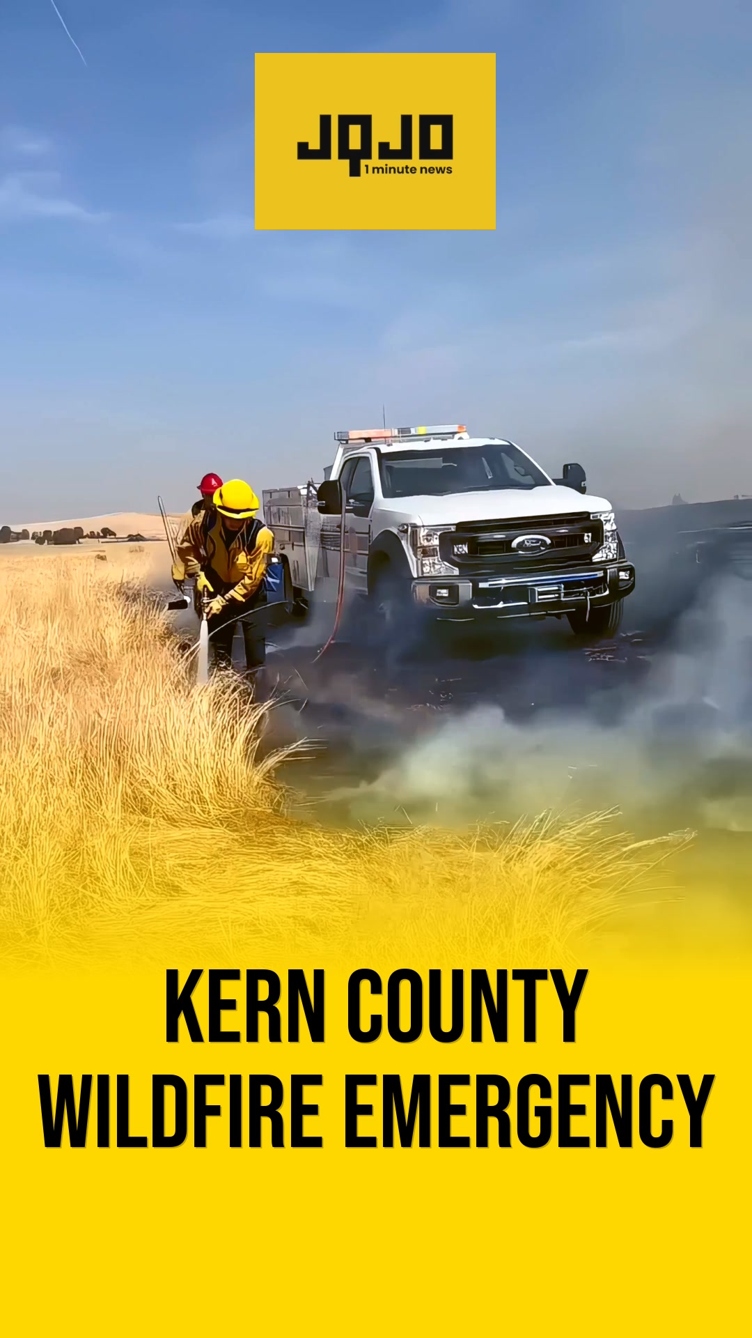
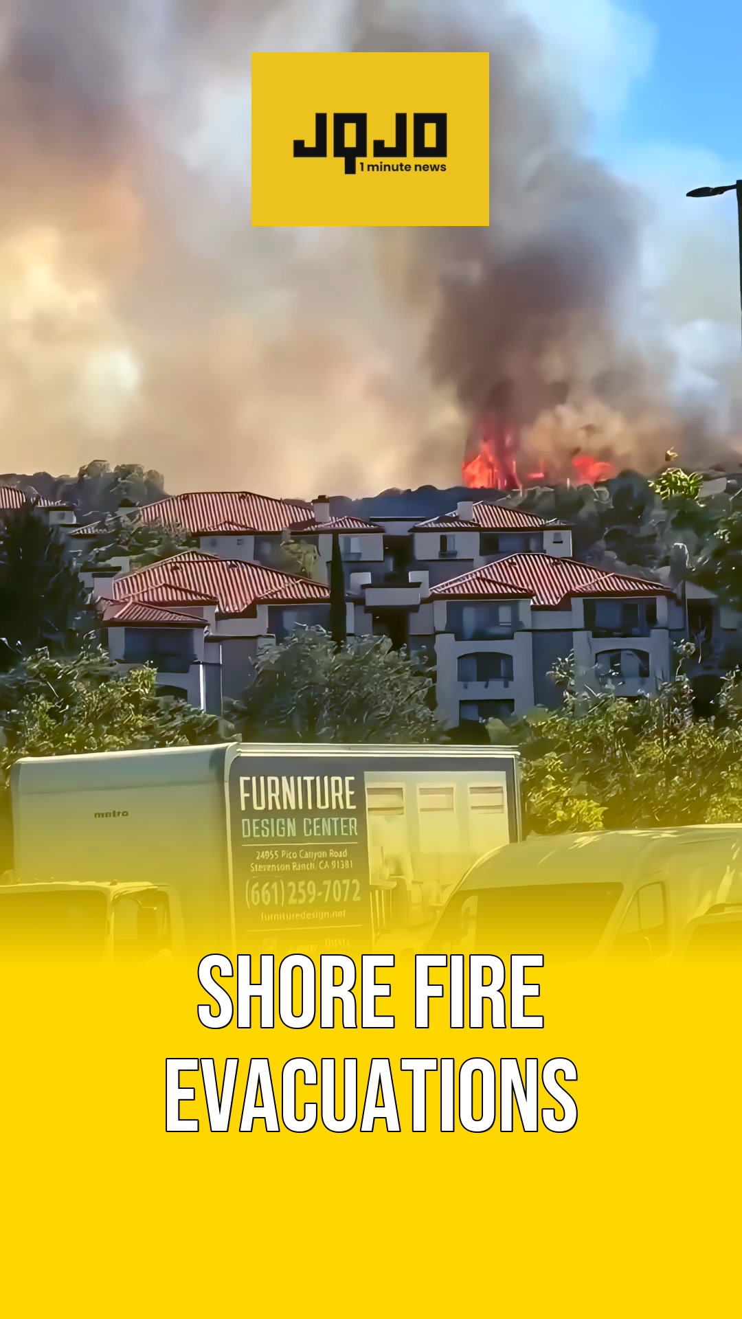
KERN COUNTY, California – A fast-moving wildfire known as the Lost Fire is burning in Kern County between Bakersfield and San Luis Obispo, where it has scorched 4,324 acres and is only 5% contained as of Friday, June 19. The blaze is advancing through an area vulnerable to rapid fire spread because of dry fuels and high temperatures, and officials say steep, difficult terrain is complicating suppression efforts. The California Department of Forestry and Fire Protection (CAL FIRE) is deploying both air and ground crews to build and reinforce containment lines as they work to slow the fire’s progress. KERN COUNTY, California – The Lost Fire is intensifying as broader fire weather threats emerge across the western United States, with meteorologists issuing red flag warnings for Northern California, Oregon, Idaho, Nevada, Utah and Arizona. The National Weather Service warns that abundant lightning combined with existing dry fuels could trigger numerous new ignitions, while wind gusts in the western mountains could reach up to 55 mph, increasing the risk of erratic fire behavior and expansion into populated or vulnerable areas. State and local emergency management agencies remain on high alert and are advising residents in at-risk zones to closely monitor official channels for any evacuation notices or updated safety guidance.
Prepared by Olivia Bennett and reviewed by editorial team.
Timeline of Events
- Friday, June 19 Lost Fire reported in Kern County
- Friday, June 19 Fire area reaches 4,324 burned acres
- Friday, June 19 Containment estimated at only five percent
- Friday, June 19 CAL FIRE deploys air and ground resources
- Friday, June 19 Difficult terrain impedes containment efforts
- This week NWS issues widespread red flag warnings
- This week Forecast winds up to fifty-five miles
- This week Officials advise residents to monitor evacuations
Why This Matters to You
The Lost Fire's rapid spread is a safety concern. It's not just a California issue. With red flag warnings across the western U.S., fire risks are high. If you live in these areas, stay alert. Monitor local news for evacuation notices.
The Bottom Line
Wildfires, like the Lost Fire, are unpredictable and dangerous. High winds and dry conditions can fuel their spread. Your best defense is to stay informed and prepared. Worth forwarding if you know someone in a high-risk area.
- Articles Published:
- 1
- Right Leaning:
- 0
- Left Leaning:
- 0
- Neutral:
- 1
- Distribution:
- Left 0%, Center 100%, Right 0%
Not specified in source.
Not specified in source.
Coverage of Story:
From Left
No left-leaning sources found for this story.
From Right
No right-leaning sources found for this story.


Comments