Gulf of Mexico Hypoxic Dead Zone Shrinks to Historic Low
Tap title to read story
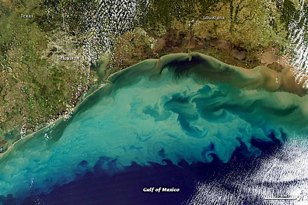
The National Oceanic and Atmospheric Administration announced that the annual hypoxic dead zone in the Gulf of Mexico measured 1,332 square miles this summer, marking the second-smallest size recorded in forty years of federal monitoring. The low-oxygen area, which forms seasonally from nutrient runoff delivered via the Mississippi River basin, decreased significantly below long-term target thresholds established by federal and state environmental task forces. Federal scientists and agricultural researchers attributed the reduction to improved nutrient management, fertilizer efficiency, and targeted conservation practices implemented across upstream Midwest farming operations. The five-year average size of the zone adjusted downward to 3,745 square miles, reflecting measurable changes in regional watershed management and weather-driven water mixing patterns. Environmental agencies and agricultural departments continue monitoring water quality metrics as researchers analyze the long-term effectiveness of ongoing watershed conservation initiatives across the Mississippi River drainage basin.
More context
Timeline
- On July 15, 1985, federal scientists initiated systematic seasonal monitoring of Gulf hypoxic zones.
- On August 20, 1990, researchers documented early historical peaks in seasonal nutrient runoff volume.
- On June 12, 2001, the federal task force released initial reduction strategy targets.
- On July 25, 2017, monitoring teams recorded a historic maximum dead zone measurement.
- On August 10, 2022, agricultural agencies expanded voluntary upstream nutrient management incentive programs.
- On September 4, 2024, annual survey figures indicated a moderate drop in total area.
- On June 1, 2025, spring rainfall patterns altered projected seasonal nutrient delivery rates.
- On August 1, 2025, federal researchers began field sampling across the continental shelf.
- On September 4, 2026, officials announced the dead zone measured 1,332 square miles.
- On September 4, 2026, researchers published updated five-year average watershed statistics publicly.
Why it matters
Immediate US impact: Agricultural stakeholders face immediate pressure to sustain voluntary nutrient reductions. Possible long-term US impact: Long-term watershed restoration could significantly improve regional marine ecosystem health. Most affected groups: Midwest farmers, environmental agencies, and commercial fisheries are most affected. Reader priority: Readers should prioritize official federal monitoring releases and scientific journals.
Coverage notes
Left: Emphasizes climate action and federal environmental protection regulatory enforcement. Center: Reports official data neutrally focusing on scientific measurements. Right: Highlights agricultural innovation and voluntary farming conservation achievements.
Primary report
NOAA released annual Gulf of Mexico hypoxic zone measurement data.
Sources
JQJO Editorial Desk · Human reviewed · AI assisted. Report a correction.