بجلی کے طوفان اور شدید طوفان کی ایمرجنسی: مڈویسٹ اور گریٹ لیکس
Read, Watch or Listen

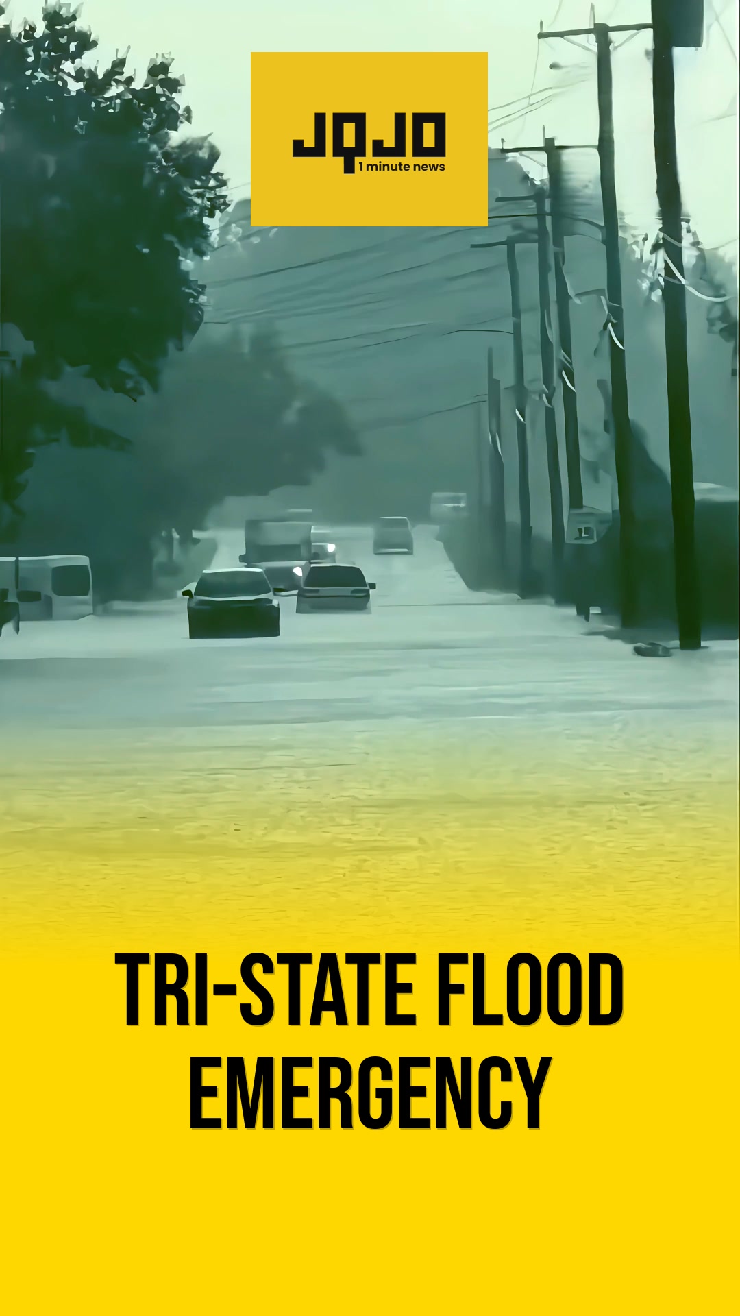
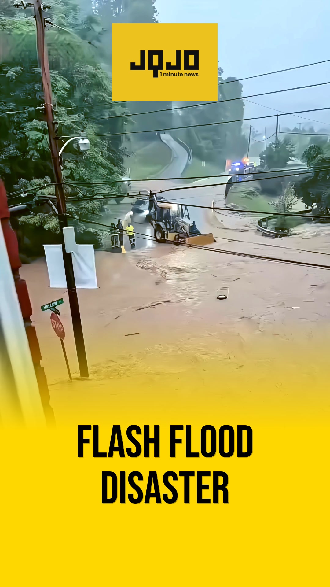
امریکہ کے مڈویسٹ اور گریٹ لیکس میں شدید موسمی صورتحال پیدا ہو رہی ہے، جس میں 11 جون 2026 کی جمعرات کی رات تک گرج چمک کے طوفانوں، بڑے اولوں اور نقصان دہ ہواؤں کا بڑھا ہوا خطرہ ہے۔ نیشنل ویدر سروس نے جنوبی اور مشرقی آئیووا اور شمال مشرقی مسوری سے لے کر شمالی اور وسطی الینوائے، جنوبی وسکونسن، شمالی انڈیانا، اور وسطی اور جنوبی لوئر مشی گن تک ایک وسیع علاقے کے لیے انتباہ جاری کیے ہیں۔ موسمیات کے ماہرین طوفان کی شدت اور ممکنہ میسوسکیل کنویکٹیو سسٹم کو تیز کرنے والے ایک طاقتور مڈ-لیول ٹرف اور غیر معمولی تیز ہواؤں کا حوالہ دیتے ہیں۔ حکام رہائشیوں پر زور دیتے ہیں کہ وہ انتباہات کی نگرانی کریں، پناہ گاہ کے منصوبوں کو محفوظ بنائیں، اور خطرناک سفر اور مقامی سیلاب کے لیے تیار رہیں۔
Prepared by Olivia Bennett and reviewed by editorial team.
Timeline of Events
- جون 2026 کے اوائل: طاقتور درمیانی سطح کا گڑھا تیار ہوتا ہے
- 10 جون 2026: تیز اوپری سطح کی ہوائیں مضبوط ہوتی ہیں
- 11 جون 2026: شدید موسمی خطرات میں اضافہ جاری
- 11 جون 2026: میسوسکیل کنویکٹیو سسٹم کی پیش گوئی
- 11 جون 2026: سپرسیل کی نشوونما کے خطرے کے بارے میں بتایا گیا
- 11 جون 2026: حکام متعدد الرٹ کے طریقوں پر زور دیتے ہیں
- جمعرات شام، 11 جون 2026: طوفان مشرق کی طرف بڑھتے ہیں
- جمعرات کی رات، 11 جون 2026: خطرناک سفر، سیلاب کا امکان
Why This Matters to You
شدید موسم آپ کی روزمرہ کی معمولات کو خلل کا شکار کر سکتا ہے۔ یہ بجلی کی بندش، فلائٹ منسوخی، اور ڈرائیونگ کو خطرناک بنا سکتا ہے۔ صورتحال سے باخبر رہنا بہت ضروری ہے، خاص طور پر اگر آپ متاثرہ علاقوں میں رہتے ہیں۔ اپنے ایمرجنسی کٹ کو چیک کریں اور اپنے خاندان کے حفاظتی منصوبے کا جائزہ لیں۔
The Bottom Line
یہ ایک ممکنہ طور پر خطرناک موسمی صورتحال ہے۔ حکام سب پر زور دیتے ہیں کہ وہ وارننگز کی نگرانی کریں اور ممکنہ سفری رکاوٹوں اور سیلاب کے لیے تیار رہیں۔ یہ ایک اچھا وقت ہے کہ آپ اپنے پیاروں کو بھی ایسا کرنے کی یاد دلائیں۔ اگر آپ مڈویسٹ یا گریٹ لیکس کے علاقے میں کسی کو جانتے ہیں تو اسے فارورڈ کرنا قابل قدر ہے۔
Coverage of Story:
From Left
No left-leaning sources found for this story.
From Right
No right-leaning sources found for this story.


Comments