Cold Fronts Sweep East, Bringing Brief Showers, Clearing
Tap title to read story
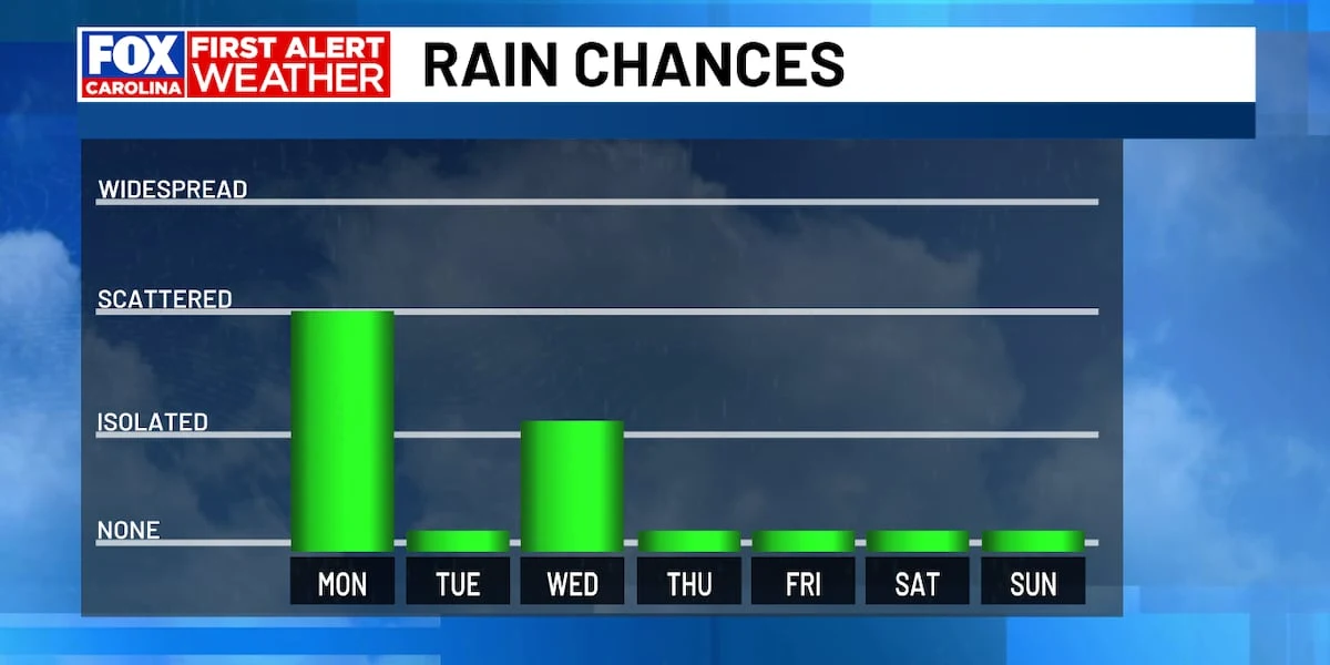
Greenville, S.C. — A series of quick-moving cold fronts moved across parts of the Eastern and Midwestern United States Monday, bringing scattered light showers and isolated thunderstorms in the afternoon and evening. Meteorologists reported clearing skies by the night, with daytime highs ranging from the mid-50s in Mid-Michigan to the mid-70s in parts of the Carolinas and Kentucky this week.
Indianapolis and surrounding areas saw dry conditions at the start of the week before rain and storms returned Tuesday night; WISH-TV noted isolated stronger storms possible north and west of the metro. Michigan stations issued a Frost Advisory that expired Monday morning, and forecasters across the region said sunshine should return Tuesday with another frontal passage expected into Wednesday.
More context
Timeline
- 1. Weekend: Pleasant weather persists across many regions prior to frontal arrival.
- 2. Monday: Cold front crosses regions, producing scattered showers and isolated thunderstorms during the afternoon.
- 3. Monday night: Showers exit; skies clear and temperatures drop, producing frost risk in sheltered valleys.
- 4. Tuesday: Sunshine returns; highs rebound into the 60s and 70s across most areas.
- 5. Tuesday night–Wednesday: Second frontal passage brings scattered light rain and isolated stronger storms.
Why it matters
These cold fronts can affect your daily routines. Expect some rain showers and possible thunderstorms. If you're in Michigan, watch out for frost. It's a good time to check your home's weatherproofing and car's tire pressure.
Sources
JQJO Editorial Desk · Human reviewed · AI assisted. Report a correction.