Heat, seabreeze trigger scattered storms across multiple regions
Tap title to read story
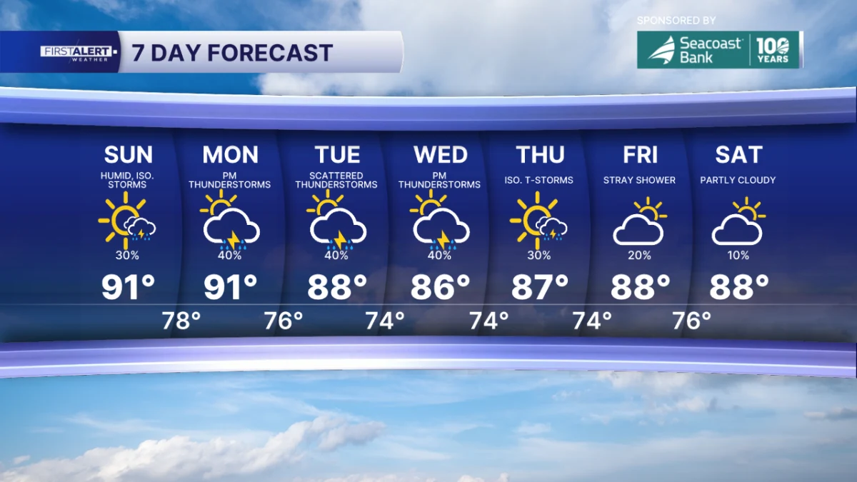
West Palm Beach, Fla. — Meteorologists forecast scattered showers and thunderstorms Sunday afternoon and evening across South Florida and parts of the Gulf Coast, driven by daytime heating and seabreeze interactions; inland cells were expected around 2–6 p.m., with coastal activity developing roughly 5–8 p.m., and highs topping the upper 80s to low 90s.
Locally heavy downpours, frequent lightning, gusty winds and small hail were cited as possible impacts, with heat indices near or above 100°F in some areas; the Storm Prediction Center noted a marginal risk across portions of southeast Louisiana, and forecasters warned that an approaching front would increase storm coverage on Monday, prompting continued monitoring.
More context
Timeline
- 1. Yesterday: heavy rain produced fog along and near the I-10 corridor (Baton Rouge area).
- 2. Sunday morning: heat and humidity increased across Florida and adjacent regions, setting up instability.
- 3. Sunday afternoon-evening: inland storms developed roughly 2–6 p.m.; coastal activity shifted 5–8 p.m.
- 4. Sunday night: storms weaken and become more isolated by 11 p.m.–midnight in some areas.
- 5. Monday: an approaching frontal system increases storm coverage with more widespread showers and localized heavy rain expected.
Why it matters
These storms can disrupt your daily routines. They may cause power outages, traffic delays, and even property damage. If you're in the affected areas, stay updated on the weather. Plan your outdoor activities accordingly.
Sources
JQJO Editorial Desk · Human reviewed · AI assisted. Report a correction.