وسطی انڈیانا میں پیر سے گرج چمک کے ساتھ طوفان، شدید طوفانوں کا امکان
Read, Watch or Listen
انڈیانا پولس — پیر، 27 اپریل، 2026 سے شروع ہونے والے وسطی انڈیانا اور آس پاس کے علاقوں میں گرج چمک کے ساتھ طوفان کے متعدد سلسلے متوقع ہیں، اور ماہرین موسمیات خبردار کر رہے ہیں کہ کچھ طوفان شدید ہو سکتے ہیں۔ مقامی اسٹیشنوں نے صبح دیر گئے یا دوپہر کے اوائل میں ایک ابتدائی جھرمٹ کے ممکنہ طور پر داخل ہونے کی وضاحت کی، جس کے بعد دن کے آخر اور شام میں شدید ترقی کا امکان ہے۔
Prepared by Olivia Bennett and reviewed by editorial team.
Timeline of Events
- اختتامِ ہفتہ: بارش نے مشرقی ٹینیسی میں جزوی خشک سالی سے نجات دلائی، جس سے بڑے خسارے میں کمی واقع ہوئی۔
- پیر کی صبح-دوپہر: وسطی مغرب کے علاقوں بشمول انڈیانا اور الینوائے میں بارش کے بادل اور تنہا طوفان پیدا ہوئے۔
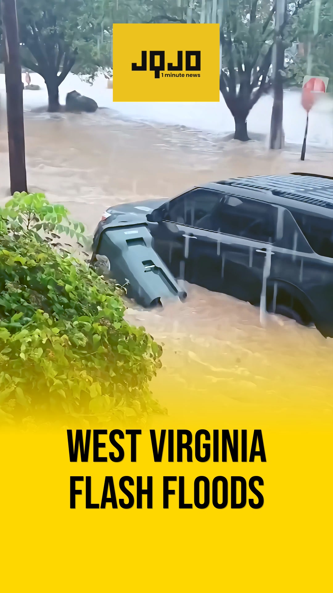
- پیر شام-رات: تیز سے شدید طوفانوں کی ایک زیادہ منظم لکیر کینٹکی اور وسطی علاقوں کی طرف مشرق کی جانب بڑھے گی۔
- منگل کی صبح: مشرقی ٹینیسی کے کچھ حصوں میں صبح 2 بجے سے 10 بجے کے درمیان شدید طوفانوں کے امکان کے ساتھ ایس پی سی کا معمولی خطرہ والا علاقہ متوقع ہے۔
- بدھ: مزید بکھری ہوئی بارش اور سرد موسم آئے گا، جس سے سرگرم سلسلہ ختم ہو جائے گا۔
Why This Matters to You
یہ طوفان آپ کے روزمرہ کے معمولات کو متاثر کر سکتے ہیں۔ ان کی وجہ سے بجلی کی بندش، ٹریفک میں تاخیر، اور اسکول بند ہو سکتے ہیں۔ اگر آپ خطرناک علاقوں میں ہیں، تو شدید موسم کے لیے تیار رہیں۔ اپنے ہنگامی سامان کی جانچ کریں اور یقینی بنائیں کہ آپ کے آلات چارج ہیں۔
The Bottom Line
شدید موسم ہماری طرف بڑھ رہا ہے، جس میں تیز ہوائیں، اولے، اور الگ تھلگ طوفانوں کا امکان ہے۔ الرٹ رہیں، مقامی موسم کی خبروں پر عمل کریں، اور احتیاطی تدابیر اختیار کریں۔ یہ فائدہ مند ہے کہ اسے متاثرہ علاقوں میں اپنے دوستوں اور اہل خانہ کو بھیج دیں تاکہ وہ بھی تیاری کر سکیں۔
- Articles Published:
- 6
- Right Leaning:
- 0
- Left Leaning:
- 0
- Neutral:
- 6
- Distribution:
- Left 0%, Center 100%, Right 0%
ایسٹ ٹینیسی میں موسلا دھار بارش نے جزوی طور پر خشک سالی سے نجات دلائی، جس سے کسانوں اور پانی کے مینیجرز کو فائدہ ہوا جو سال کے آغاز سے 5 انچ سے زیادہ کے خسارے کا انتظام کر رہے ہیں۔
منگل کی رات سے منگل تک کئی طوفان کے دوروں کے ساتھ، پیش گوئی والے علاقوں میں رہنے والوں کو تیز ہواؤں، اولوں، ممکنہ طوفانوں اور سفری تعطل کے بڑھتے ہوئے خطرات کا سامنا ہے۔
Coverage of Story:
From Left
No left-leaning sources found for this story.
From Center
وسطی انڈیانا میں پیر سے گرج چمک کے ساتھ طوفان، شدید طوفانوں کا امکان
WISH-TV | Indianapolis News | Indiana Weather | Indiana Traffic ABC7 Chicago https://www.wvlt.tv https://www.wkyt.com WSMV Nashville WBIWFrom Right
No right-leaning sources found for this story.


Comments