Midwest Alerts: Severe Storm Risk Through Midweek Ahead
Tap title to read story
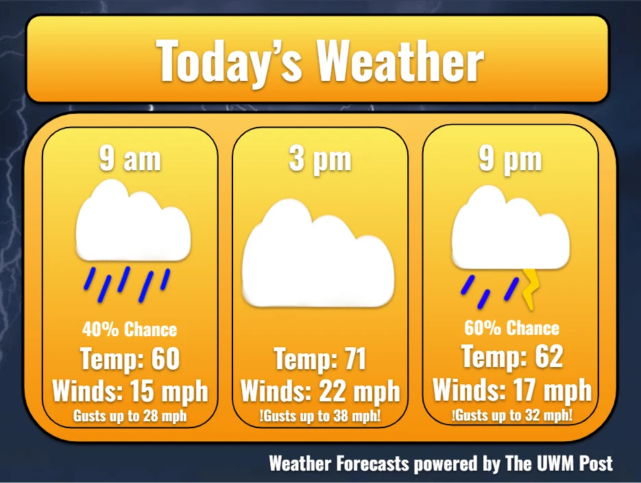
Milwaukee meteorologists issued a five-day forecast on April 12, 2026, projecting showers, gusty winds, and overnight thunderstorms with temperatures rising into the low 70s. Forecasts noted wind gusts up to 45 mph and isolated accumulations near a tenth of an inch, with showers calming early Monday morning before warmer, quieter conditions later in the day.
WAUSAU-area forecasters this week placed late Monday into Tuesday under consideration for First Alert Weather Days and likely Monday night, warning that a warm front could trigger strong to severe storms capable of producing damaging winds, large hail, and heavy rainfall; Lubbock forecasts expected isolated, lower-risk strong storms and highs in the 80s on Sunday.
More context
Timeline
- 1. Early Sunday: lingering showers and isolated storms across Wisconsin and portions of Texas.
- 2. Sunday daytime: warming with highs in the 60s–80s and breezy conditions.
- 3. Late Monday into Monday night: First Alert Weather Days considered/likely for severe thunderstorm risk.
- 4. Tuesday: additional round of showers and storms expected, with warm front influence.
- 5. Following days: warmer, steadier conditions return with continued isolated storm chances.
Why it matters
Severe storms can disrupt your daily routines and pose safety risks. Power outages, property damage, and hazardous road conditions are possible. Keep an eye on local forecasts, especially if you have outdoor plans or commutes in the coming days.
Sources
JQJO Editorial Desk · Human reviewed · AI assisted. Report a correction.