Central Florida Braces for Heavy Rain and Flooding
Tap title to read story
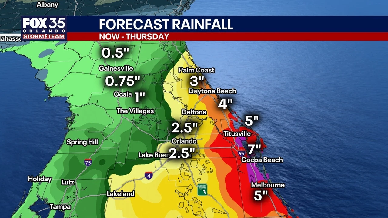
Orlando - Local weather services warn Central Florida of heavy rain, thunderstorms and dangerous surf beginning Monday, as a stalled system brings scattered downpours and isolated intense storms into Tuesday and midweek. Radar and forecasts show increasing coverage from noon with elevated lightning, wind and surf risks.
Officials have issued Flood Watches and Wind Advisories this week, with watches in effect through 8 p.m. Tuesday and wind advisories running into the night; rainfall totals of 2 to 4 inches, isolated higher amounts above 5 inches, and gusts near 45–50 mph threaten commutes, coastal flooding and erosion.
More context
Timeline
- 1. Late-night showers produced warm, humid conditions across Central Florida.
- 2. On April 6, Volusia County reported red-flag surf and three-foot waves.
- 3. Flood Watches were issued for coastal counties through 8 p.m. Tuesday.
- 4. Wind Advisories and High Surf Advisories were posted for coastal areas.
- 5. Additional energy expected late Wednesday into Thursday, prolonging flooding concerns.
Why it matters
Heavy rain and high winds can disrupt your daily routine. Commutes may take longer due to flooding and poor visibility. Coastal residents should be alert for potential erosion. Check your local weather updates and plan accordingly.
Sources
JQJO Editorial Desk · Human reviewed · AI assisted. Report a correction.