Warm day, severe storms expected across Midwest overnight
Read, Watch or Listen
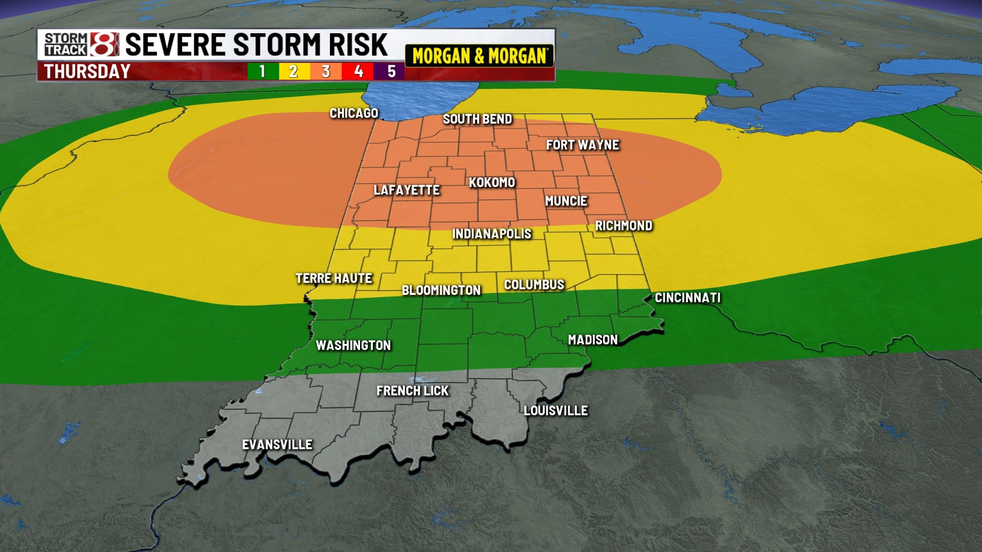
Indianapolis: Record-high temperatures are forecast for Thursday as a strong cold front approaches, with local and regional forecasts warning of strong to severe thunderstorms across parts of Indiana, Ohio and Michigan late Thursday into early Friday, concentrated from Thursday evening through the predawn hours. Authorities and weather services caution residents about large hail, damaging winds and heavy rainfall; the Storm Prediction Center and local NWS outlets emphasize evening-to-overnight timing, localized flood potential, and a pronounced temperature drop into the 30s–40s on Friday as colder air arrives.
Prepared by Olivia Bennett and reviewed by editorial team.
Timeline of Events
- Morning: Warm, breezy conditions and high humidity ahead of front.
- Afternoon: Temperatures peak in the 70s–80s; gusty south-southwest winds.
- Early evening: Cold front advances; initial showers and storms develop.
- Late evening–early Friday: Strong to severe storms likely with hail and damaging winds; localized heavy rain possible.
- Friday: Cold air arrives with temperatures falling into the 30s–40s and skies clearing.
Why This Matters to You
Severe storms can pose a safety risk. Hail and high winds can damage property. Heavy rain may cause localized flooding. The sudden temperature drop could affect your health. Check your home's readiness for severe weather. Keep an eye on elderly neighbors.
The Bottom Line
Mother Nature is throwing a curveball with record heat, severe storms, and a cold snap all in one day. Stay alert, especially during the evening and overnight hours. Worth forwarding if you know someone in Indiana, Ohio, or Michigan.
- Articles Published:
- 10
- Right Leaning:
- 0
- Left Leaning:
- 0
- Neutral:
- 10
- Distribution:
- Left 0%, Center 100%, Right 0%
Local emergency services, utility crews, and weather-dependent businesses benefited from advance warnings and preparation time to stage personnel and protect assets.
Residents and travelers in affected counties faced increased risk of property damage, travel disruption, and potential power outages from hail, damaging winds, and localized flooding.
Coverage of Story:
From Left
No left-leaning sources found for this story.
From Center
Warm day, severe storms expected across Midwest overnight
WISH-TV | Indianapolis News | Indiana Weather | Indiana Traffic WKEF https://www.cleveland19.com WSYM WKEF mlive WKEF WISH-TV | Indianapolis News | Indiana Weather | Indiana Traffic WKEF WKYC 3 ClevelandFrom Right
No right-leaning sources found for this story.


Comments