LIFESTYLE
Coastal Low Threatens Northeast, Snow Outcomes Vary Widely
PUBLISHED Feb 19, 2026, 7:57 AM ET
Read, Watch or Listen
Media Bias Meter
Sources: 7
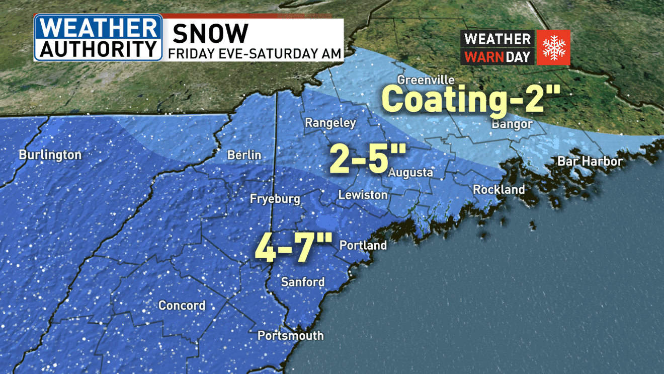
Washington — Forecasters warn a coastal low may move near the U.S. East Coast early Sunday and exit northeast by Monday. Models vary: some deepen the low offshore and draw in colder air, producing accumulating snow; others keep a marginal profile with rain or mixed precipitation. Regions from Maine to the Mid‑Atlantic and Delmarva face differing outcomes: Maine expects Friday into Saturday snowfall (2–7 inches ranges by area), Philadelphia models show a 70% chance of light snow and a 30% chance of heavier snow, and D.C.-area forecasts emphasize a rain-to-snow transition late Sunday. Based on 6 articles reviewed and supporting research.
By Adyan K. | JQJO News
Timeline of Events
- Late Wednesday–Thursday: Montana and Wyoming recorded light snowfall of 1–5 inches.
- Thursday: Low pressure began organizing off the California coast and moved eastward.
- Thursday: Maine saw sunshine before snow is forecast to arrive Friday evening into Saturday.
- Friday–Saturday: Forecast models diverged for the Mid‑Atlantic; Philadelphia models presented 70/30 scenario splits.
- Sunday into Monday: Coastal low expected to affect D.C./DMV with rain-to-snow transitions and travel-impact window.
News Intelligence
- This coastal low could affect your weekend plans. If you're in the Northeast, prepare for possible snow or mixed precipitation. Check your local forecast and plan accordingly. If you're traveling, anticipate potential delays.







Comments