Cold Snap Wraps U.S. Ahead Of New Year
Tap title to read story
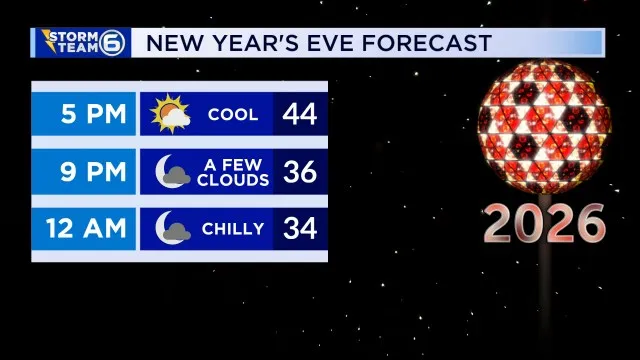
United States meteorologists report a widespread brief cold spell across multiple regions as the year ends, with lows dipping into teens and 20s in Tennessee, Alabama, and Illinois on Wednesday and New Year's Eve, while Florida and coastal areas saw cooler-than-normal temperatures in the 30s–40s. Local services prepared for frost, ice, and minor travel impacts. Forecasts show gradual warming into early January, rain or showers returning Friday into the weekend for parts of the Southeast and Gulf Coast, and seasonal thawing by mid-week. Agencies advised bundling and travel caution for slick spots. Based on 11 articles reviewed and supporting research.
More context
Timeline
- 1. Late-December: High pressure brings cold, clear nights with lows in the teens and 20s across interior states.
- 2. Dec 31 (New Year's Eve): Forecasts call for breezy but largely dry conditions for many regions; cold overnight lows expected.
- 3. Jan 1: Daytime temperatures begin rebounding into the 40s and 50s across central and southern states.
- 4. Jan 2–3: A weak low/front brings scattered showers to parts of the Southeast and Gulf Coast.
- 5. Early week after Jan 3: Widespread gradual warming returns many areas to seasonally mild temperatures.
Sources
JQJO Editorial Desk · Human reviewed · AI assisted. Report a correction.